info@ghinternational.com 202.955.9505
GH International

Our Products

Add-On Apps for the VIISE SitRoom

Your existing GIS can speak the language of non-technical public safety professionals! Get work done more simply. Bring order to your cloud. Make it easy to find new uses for what you already have and create new partnerships for improving public investments. Address your situational awareness needs the right way, and you can accomplish all of the above. Here are some apps that can help you get started.

Screenshot of a the UASI Planning Tool

Planning Tool

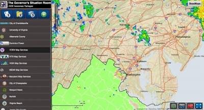
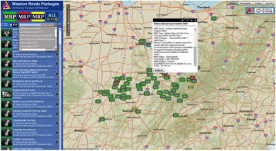
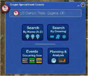
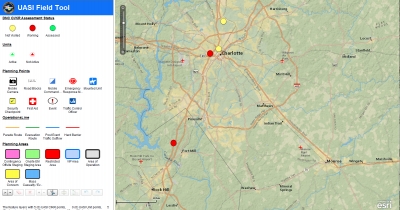
Allows users to plan collaboratively  by enabling multi-user editing of one data set.  Crowd source planning processes and create re-usable digital maps.  Like a “smart board”, the Planning Tool can help you capture planning conversations and uses your GIS server to jumpstart new collaborations within or across jurisdictions. The Planning Tool is a simple to use tool that allows an operator to geographically document situation reports. The Planning Tool can be configured for a variety of purposes and has been customized to be used as a field asset tool, event tracker and exercise inject creator. This tool was used in a Pacific Northwest exercise as part of the Virtual USA program to assist states with planning and implementing cross-border field operations.

The tool was also used during the 2011  Mississippi River floods by Kentucky Emergency Management, the 2011 National Level Exercise, and to test regional collaboration during the Virtual Northeast States Pilot in 2012.

🔍 Content Filter Tool

Allows users to geographically query predefined mission parameters to filter out unnecessary data. The tool helps users find the relevant, actionable information needed for analysis and decision making by querying multiple sources of data at the same time.

Content Directory

📕 Content Directory Tool

Provides direct access to data made available from local, state, federal, and non-government organizations through a direct link to their map services directory. The tool is customizable so that each contributor can share, brand, and use each other’s map services on demand. In addition, this tool can be used to initiate information-sharing partnerships among and within geographic regions, as well as improve the visibility and use of cloud computing geographic information systems (GIS) resources without creating endless custom websites. This application is currently integrated with the VIISE SitRoom and can be configured as a widget plugin to the Esri ArcGIS Viewer for Flex.

💥 Critical Infrastructure and Key Resource Tool

Helps emergency management and homeland security officials visualize and track the status of critical infrastructure and key resources (CIKR) in their area to inform decision making as events unfold. The tool integrates local or nationally-provided CIKR data as well as consequence analysis, risk analysis, and management models. This tool allows users to quickly and efficiently navigate large CIKR data sets by using multiple variables to query information.

Mission Ready App

Mission Ready Package Tool

Helps improve the request and acquisition of mutual aid among different organizations and individuals.  The tool assists with identifying Mission Ready Packages (MRPs) by type and status, and enables the user to update the operational status and movement of MRPs from the Mutual Aid Support System and other resource databases and acquisition processes.  This tool is being used to support requests for mutual aid resources for the Central US Earthquake Consortium's Capstone 2014 Exercise.

Special Event Console

📅 Special Events Planning Tool

Enables event organizers, executives, and first responders to manage and coordinate hundreds of concurrent events.  This tool can integrate dozens of stakeholders at every level of government, the private sector, and other parties as needed.

Let us help you
get the information you need.

Contact Us